|
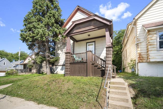
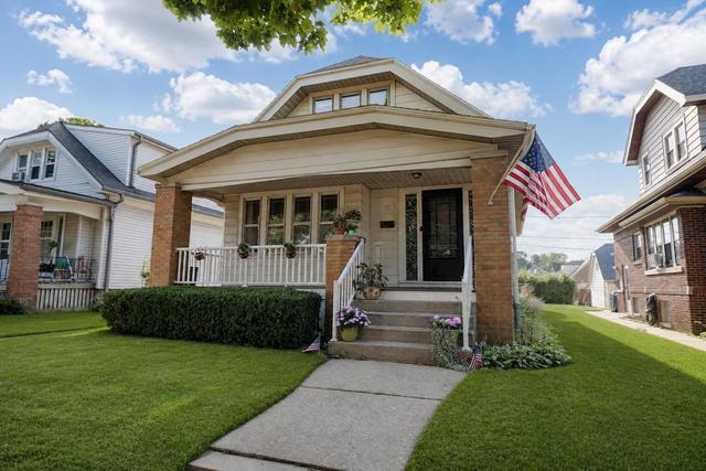
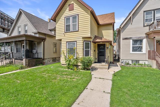
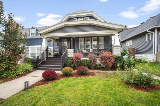
Alverno sits on Milwaukee’s south side just west of I-43, giving residents quick freeway access to downtown while remaining a short drive from the airport and the lakefront. The neighborhood is anchored by Alverno College, whose campus and athletic fields occupy several blocks and draw faculty, staff, and students who support nearby shops and restaurants along Oklahoma Avenue. Single-family homes on tree-lined streets sit within walking distance of Alverno’s library and performing-arts center as well as several MPS elementary and middle schools.
... Read more
|
|
|
|
Burnham Park sits on Milwaukee’s near south side, bordered by major thoroughfares that place residents minutes from downtown, the Third Ward, and the lakefront via I-94 and nearby bus routes. The area features a grid of older single-family homes and duplexes alongside several neighborhood parks and the Burnham Park Senior Center, which hosts regular city-run programs. Families are served by Milwaukee Public Schools options that include a K-8 Montessori program and nearby high schools, while daily errands are supported by supermarkets and small retail strips along nearby Lincoln and Layton avenues.
... Read more
|
|
|
|
Clarke Square sits just south of downtown Milwaukee and is bordered by the Menomonee River Valley to the north and the Kinnickinnic River to the east. The neighborhood’s grid of early-20th-century homes and duplexes is served by the 15th Street and 16th Street commercial corridors, where residents walk to grocery stores, taquerias, and bus routes that reach downtown in under ten minutes. Lincoln Park and the Hank Aaron State Trail provide immediate outdoor access, while nearby South Division High School and several Milwaukee Public Schools elementaries serve local families.
... Read more
|
|
|
|
Forest Home Hills sits on Milwaukee’s south side, bounded by major corridors that connect residents to downtown in roughly 15 minutes by car and to the airport in under 10. Its grid of older single-family homes is interspersed with small neighborhood parks and within walking distance of the Forest Home Cemetery’s tree-lined grounds. The neighborhood is served by Milwaukee Public Schools, including nearby elementary options, and lies close to the commercial strips along Forest Home Avenue and Oklahoma Avenue for everyday shopping and dining.
... Read more
|
|
|
|
Harder Oaks sits on Milwaukee’s northwest side between the Menomonee River Parkway and the Oak Leaf Trail, giving residents direct access to wooded trails and riverfront parks. The neighborhood’s mid-century and ranch-style homes are set on larger, tree-lined lots that back up to conservation land, creating a quieter, more private setting within the city. It is minutes from Wauwatosa’s commercial corridors, several MPS and suburban school options, and quick freeway connections to downtown Milwaukee.
... Read more
|
|
|
|
Historic Mitchell Street sits on Milwaukee’s near south side, just minutes from downtown via I-94 and Lake Parkway, giving residents quick access to employment centers and lakefront parks. The neighborhood’s early-20th-century two-story brick homes and corner storefronts create a distinct architectural character, while the active Mitchell Street commercial corridor supplies groceries, pharmacies, and restaurants within walking distance. Families are served by nearby Milwaukee Public Schools such as Clement Avenue Elementary and Audubon Technology & Communication Center, and several bus routes converge along the corridor for car-free commuting.
... Read more
|
|
|
|
Jackson Park sits on Milwaukee’s southwest side, bordering the 220-acre park of the same name that includes lagoons, trails, and athletic fields. Residents reach downtown in roughly ten minutes by car via I-94 or the Hank Aaron State Trail, while the nearby 27th Street corridor supplies groceries, pharmacies, and restaurants. The neighborhood’s single-family homes and duplexes are served by Milwaukee Public Schools, including nearby Whittier and Hamilton options, and many properties back up to or face the park’s green space.
... Read more
|
|
|
|
Layton Park sits on Milwaukee’s south side just west of the airport and south of I-94, giving residents quick freeway access and a 10-minute drive to downtown. Its grid of modest early-20th-century bungalows and two-story homes is anchored by several neighborhood parks and the Kinnickinnic River corridor, which offers paved trails and green space. The commercial strip along Layton Avenue supplies daily shopping and dining, while nearby South 27th Street provides additional retail and restaurant options.
... Read more
|
|
|
|
Lincoln Village sits on Milwaukee’s south side, providing direct access to the 794 and 43 highways for commutes to downtown or the airport. The neighborhood’s blocks of early-20th-century bungalows and two-flats are served by Lincoln Park, several neighborhood groceries, and the nearby Southgate Shopping Center. South Division High School and nearby Milwaukee Public Schools elementary options place families within the district’s established attendance boundaries.
... Read more
|
|
|
|
Morgandale sits on Milwaukee’s south side, bordered by major streets that connect residents directly to downtown and the airport in under fifteen minutes by car. Single-family homes on tree-lined blocks stand near established neighborhood parks and the Kinnickinnic River corridor, which offers walking and biking paths. Local elementary and middle schools serve the area, and everyday shopping and dining options line nearby Lincoln and Layton avenues.
... Read more
|
|
|
|
Muskego Way sits on Milwaukee’s south side with direct access to I-43 and I-894, allowing short drives to downtown and the airport. The neighborhood contains single-family homes on established blocks alongside several city parks and the Hank Aaron State Trail for outdoor recreation. Nearby commercial corridors on Oklahoma Avenue and Lincoln Avenue provide grocery stores, restaurants, and daily services, while the area falls within Milwaukee Public Schools boundaries.
... Read more
|
|
|
|
National Park sits on Milwaukee’s near-west side, directly adjacent to Washington Park and within a short drive of the Milwaukee Regional Medical Center and downtown. The neighborhood’s stock of early-20th-century bungalows and two-flats lines quiet, tree-lined streets that offer quick access to the Hank Aaron State Trail and the Menomonee River Parkway for walking and cycling. Families are drawn to the area’s proximity to several MPS schools and the frequent bus routes along North Avenue that connect residents to jobs, shopping, and cultural institutions without needing a car for daily errands.
... Read more
|
|
|
|
Polonia sits just south of downtown Milwaukee, bordered by Lincoln Avenue and the Kinnickinnic River. The neighborhood’s grid of early-20th-century duplexes and single-family homes sits within walking distance of Lincoln Park, Kosciuszko Park, and the Hank Aaron State Trail. Residents reach I-43/94 and the airport in under ten minutes, while several MPS elementary and middle schools, plus South Division High School, lie inside the neighborhood boundaries.
... Read more
|
|
|
|
Silver City sits just west of downtown Milwaukee along the Menomonee River, giving residents quick access to the Hank Aaron State Trail and the Menomonee Valley recreation corridor. The neighborhood’s older single-family homes and duplexes stand near Mitchell Park and the Domes, while several bus routes and the nearby 27th Street corridor provide direct routes to employment centers and Miller Park. Local schools include the Milwaukee Spanish Immersion School and nearby options within Milwaukee Public Schools, and everyday shopping and dining are available along National Avenue and Cesar E. Chavez Drive.
... Read more
|
|
|
|
Southgate sits on Milwaukee’s far south side, just off Interstate 94 and within a short drive of Mitchell International Airport and the Oak Leaf Trail. The neighborhood’s grid of mid-century ranch and Cape Cod homes sits near Southgate Shopping Center and several parks, while South Division High School and nearby elementary options serve local families. Its direct freeway access and established residential blocks appeal to buyers seeking convenient commuting and everyday retail within city limits.
... Read more
|
|